NATIONAL PARKS IN EAST JERUSALEM
Visit the parks to see how East Jerusalem is being made Jewish and the lives of its Palestinian residents made miserable.
Since the annexation of East Jerusalem to Israel, Israeli governments have established five national parks on annexed land. Another three parks are currently in preliminary planning. The parks border populated Palestinian neighborhoods, and in some cases encroach on the neighborhoods proper. No construction is allowed in national parks. Therefore, declaring areas as national parks serves as a means of restricting construction and development of Palestinian neighborhoods in Jerusalem. The establishment of the parks promotes an agenda of ensuring a Jewish majority in Jerusalem, creating a contiguous bloc of lands with no Palestinian population, and expanding the Jewish presence in East Jerusalem.
* In this project, we chose to use irreverent humor to convey the way in which national parks are used as a ploy to take over Palestinian land and prevent the development of Palestinian neighborhoods.
Start The Tour
Jerusalem Walls National Park
An exquisite spot famed for its remarkable facility to restrict Palestinian construction.
Spray-paint anti-Palestinian slogans as you walk.
Declared: 1974
Area: 110 hectares, more than half in East Jerusalem
 The park encircles the Old City wall and includes almost the entire neighborhood of Wadi Hilwa in Silwan. Definition of the neighborhood as a national park means residents are prohibited from building there. Having no other choice, some residents build without permits, risking demolition. The neighborhood also suffers from a dearth of public facilities. The City of David archeological run by El-Ad, an Israeli NGO which promotes Jewish settlement in East Jerusalem, is located in the center of the neighborhood. The site and the archeological digs have resulted in making open spaces off-limits to local residents; visitors to the site create traffic jams in the neighborhood; dozens of armed security officers have been stationed in the neighborhood and surveillance cameras installed. Plans for the Kedem Center, a visitor compound in the heart of Wadi Hilwa, were approved in April 2014. The center is expected to significantly increase the number of tourists in the neighborhood, and El-Ad has been assigned operation of the Kedem Center as well.
Info on neighborhoods harmed:
Wadi Hilwa
Wadi al-Joz
Abu Tur
Wadi Hilwa (Silwan)
Population:
about 4,000 Palestinians, about 300 Jewish settlers
Homes:
More than 250 structures with more than 700 apartments.
Planning status:
The area of the neighborhood has been zoned as a special open space, where no residential buildings or public facilities may be built. Any other activity or usage requires special authorization from municipal planning institutions. As a result, almost all construction in the neighborhood, including tourist facilities and the settlers’ homes, has been carried out without permits. Palestinian residents suffer from a severe shortage of residential units and public facilities.
National parks:
The neighborhood is located almost entirely within the Jerusalem Walls National Park, including the City of David site, run by El-Ad.
House demolitions:
From 2006 through April 2014, about 15 residential buildings were demolished throughout Silwan, including Wadi Hilwa. (B’Tselem figures).
Abu Tur
Population:
about 15,500
Planning status:
The building rights approved for the neighborhood have been almost completely exhausted and the neighborhood has no prospects for expansion. Almost all construction in the neighborhoods is undertaken without permits, and consequently faces the threat of demolition. Residents suffer from a shortage of public facilities, an insufficient and incomplete road system and dilapidated infrastructure.
National parks:
An early version of the Jerusalem 2000 Master Plan allocated an area of about 2 hectares, bordering on Abu Tur’s built up area, for the expansion of the Jerusalem Walls national park. The NPA has already constructed an observation point in this spot, despite the fact that it is not officially part of the national park. The Jerusalem Municipality has demolished an agricultural structure at the site and uprooted about ten ancient olive trees.
Wadi al-Joz
Population:
about 17,000
Planning status:
The planned parts of the neighborhood have been allowed relatively little construction, incongruent with its urban character. Other parts of the neighborhood, which entirely lack planning, are densely built. The neighborhood has a shortage of land reserves for construction.
National parks:
The Jerusalem Walls National Park includes a 5.6 hectare area in southwest Wadi al-Joz. The area is currently used by residents as a market and parking lot and also contains a few homes. A mostly vacant area of about 4 hectares inside the neighborhood made a part of Tzurim Valley National Park. A similarly sized area (around the Rockefeller Museum) may also be turned into a national park.
Next Park
Tzurim Valley National Park
One of a kind! A park boasting absolutely no natural or archeological attractions.
Bring a deck of cards, there’s nothing to see or do.
Declared: 2000
Area: 17 hectares
The park was declared in an area devoid of any significant archeological findings or natural treasures. The Nature and Parks Authority (NPA) has explained that the park is necessary for creating geographic contiguity with the Jerusalem Walls National Park, and to re-create the ancient agrarian landscape. The park creates a continuous bloc of land from the Old City to Mount Scopus that is off-limits to Palestinian construction. The park is being developed to serve a target audience of Israelis and tourists. Aiming to unearth Jewish relics, El-Ad runs an on-site project for sifting soil dumped by the Waqf when it carried out construction on the Temple Mount. The park was declared without taking into consideration the day-to-day needs of the residents on whose neighborhoods it was built – the Palestinian neighborhoods of a-Sawaneh and Wadi al-Joz.
Info on neighborhoods harmed:
A-Sawaneh
Wadi al-Joz
A-Sawaneh
Population:
about 3,000
Planning status:
The municipal plans that have been in effect in the neighborhood since 1976 allow only limited construction. Almost the entire area designated in these plans as residential is already built up.
National parks:
Tzurim Valley National Park was declared on a large open area in the northern part of the neighborhood. In addition, in an early version of the Jerusalem 2000 Master Plan, the Jerusalem Municipality marked a national park on the Mount of Olives, surrounding the neighborhood from the south and the west. Together, the two parks block in the neighborhood from almost all sides, leaving no avenue for development.
Wadi al-Joz
Population:
about 17,000
Planning status:
The planned parts of the neighborhood have been allowed relatively little construction, incongruent with its urban character. Other parts of the neighborhood, which entirely lack planning, are densely built. The neighborhood has a shortage of land reserves for construction.
National parks:
The Jerusalem Walls National Park includes a 5.6 hectare area in southwest Wadi al-Joz. The area is currently used by residents as a market and parking lot and also contains a few homes. A mostly vacant area of about 4 hectares inside the neighborhood made a part of Tzurim Valley National Park. A similarly sized area (around the Rockefeller Museum) may also be turned into a national park.
Next Park
Mount Scopus Slopes National Park
Spectacular ‘green lung’ smothers al-‘Esawiyah and a-Tur.
Start your tour at the District Planning Committee visitors’ center.
Approved, awaiting further hearing at District Committee
Area: 73 hectares
 The park incorporated the only land reserves available to the neighborhoods of al-‘Esawiyah and a-Tur. Residents of these two neighborhoods have been trying for years to advance master plans that would allow development in their overcrowded communities on these very land reserves. The designation of these lands for the park runs contrary to an agreement residents of al-‘Esawiyah reached with the Jerusalem Municipality and the NPA. Political interference in the park’s planning process and its generous borders reinforce suspicions that the park was actually meant to serve the unacceptable goal of restricting Palestinian construction in East Jerusalem. In November 2013, the District Committee approved the plan, contrary to the expert recommendation given by Environmental Protection Minister Amir Peretz. Local residents and Israeli NGOs Bimkom and Ir Amim appealed the decision to the National Planning and Building Committee. In September 2014 the committee stated that the park’s border could not be determined without thoroughly investigating the needs of adjacent neighborhoods. The plan was returned to the District Committee for further review.
Info on neighborhoods harmed:
Al-'Esawiyah
A-Tur
Al-'Esawiyah
Population:
about 15,500
Residential units:
about 2,300
Planning status:
In 1991, the Jerusalem Municipality approved a master plan for the neighborhood. The plan, which covers about 67 hectares, fails to meet the neighborhood’s planning and development needs. Residents live in overcrowded conditions and suffer from insufficient basic public infrastructure. In 2004, neighborhood residents, along with Israeli NGO Bimkom, began a planning process for the neighborhood in coordination with planning bodies of the municipality and the Ministry of Interior. The borders of the neighborhood’s planned expansion were determined in coordination with the NPA.
National parks:
Planning for the Mount Scopus Slopes National Park began in 2005. The park is located south of the built up part of al-'Esawiyah and on its lands. In breach of the agreement between the residents and the authorities, the planned park incorporates the neighborhood’s last remaining land reserve in its entirety. This reserve was to be used for the neighborhood’s expansion and development.
House demolitions:
From 2006 through April 2014, the Jerusalem Municipality and the Ministry of Interior demolished 35 residential units and seven non-residential structures in al-'Esawiyah (B’Tselem figures).
A-Tur
Population:
about 23,000
Residential units:
More than 3,000
Planning status:
Neighborhood residents suffer from overcrowding and high population density. They are forced to build without permits, risking demolition. The neighborhood has a shortage of buildings for education and culture as well as a shortage of sports and leisure facilities. Road, drainage and sewage infrastructure is old and dilapidated. An area known as Khalat al-‘Ein in the north of a-Tur is the neighborhood’s only remaining land reserve, but under existing plans most of it is defined as open space where construction is prohibited. In the remainder of this area, only low construction is permitted. A-Tur residents initiated a planning process for Khalat al-‘Ein that would meet their needs, and in March 2011, the municipality said it would help advance the plan.
National parks:
Mount Scopus Slopes National Park, approved in November 2013, partly falls on the northern part of the Khalat al-‘Ein plan, where residents planned public facilities and a public park. The approved area disregards the assurance given by the Jerusalem Municipality that it would help promote the residents’ plan.
House demolitions:
From 2006 through April 2014, 52 residential units and six non-residential structures were demolished in the neighborhood (B’Tselem figures).
Next Park
Garden of the King
Planning underway. Residents soon to receive eviction orders.
See Palestinians being removed from their homes.
Local committee approval: June 2010
Area: 17 hectares
 In early 2010 the Jerusalem Municipality filed with the local planning committee a plan for a tourist park. The planned park, Garden of the King, is to be located in the al-Bustan neighborhood of Silwan. According to the plan, the park’s development called for the demolition of structures in the neighborhood’s western part (at least 22), whereas structures in the eastern part (about 66) would receive retroactive approval along with increased building rights. The plan ostensibly allows residents evacuated from the western part of the neighborhood build new homes in its eastern part. Yet the plan ignores the fact that the city has neither the power nor the capacity to allow people to build homes on land privately owned by residents in the eastern part of the neighborhood. It also ignores the municipality’s strict criteria for approving construction by local residents in East Jerusalem. These obstacles may leave no alternate housing solutions for people whose homes in the western part of the neighborhood will be demolished. The plan was approved by the local planning committee in June 2010 and is currently waiting to be presented before the District Committee.
Info on neighborhoods harmed:
Al-Bustan
Al-Bustan (Silwan)
Population:
about 1,000
Homes:
more than 90
Planning status:
The 1976 municipal master plan zones al-Bustan valley as an open space. Crowding has increased in Silwan over the years, but the neighborhood’s master plans offered no solution to the problem and residents had no choice but to build in the valley without permits. As a result, demolition orders were issued against dozens of homes in al-Bustan. Residents cannot make additions to their homes, build additional homes on their lands, build public facilities or lay down proper infrastructure.
National parks:
The Jerusalem Municipality is in the process of planning the Garden of the King National Park. The plan calls for the demolition at least 22 homes in the eastern part of the neighborhood and the retroactive approval of 66 homes in its west.
Next Park
Refa’im Stream National Park
Farmland makeover: Al-Walajah revamped! Now recreation area for Israelis only!
Spot villagers sneaking a peek at their land through the Separation Barrier.
Declared: July 2013
Area: 140 hectares
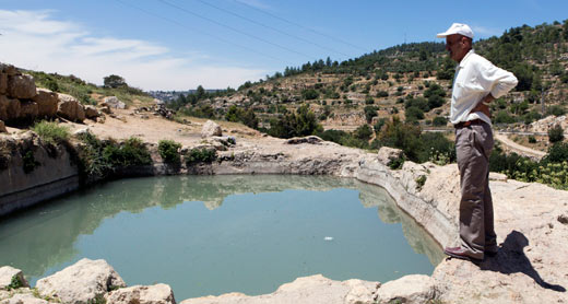 In July 2013, Refa’im Stream National Park was expanded to include areas annexed to Jerusalem’s municipal boundaries, including about 100 hectares belonging to the village of al-Walajah and used for farming and shepherding. About ten people, including children, live in this area in caves and tin shacks. According to the NPA, farmers will be permitted to continue farming and shepherding in the area, but will not be allowed to build agricultural structures, fence off plots or develop industrial agriculture. However, the planned route of the Separation Barrier will cut off al-Walajah residents from the land included in the national park, so that even if Israel grants them access to this land, experience in other parts of the West Bank has shown that this access will be partial, at best. Village residents will not be able to use their land recreationally or enjoy the park that has been declared on it.
Info on neighborhoods harmed:
Al-Walajah
Al-Walajah
Population:
about 2,500
Planning status:
About a third of the village was annexed to Jerusalem’s municipal boundaries, but residents did not receive Israeli residency status. The Jerusalem Municipality has never made a master plan for the annexed area and even rejected a plan prepared by the residents, claiming that it called for construction in areas slated to remain open. Having no other choice, some residents build without permits. About 100 cease-and-desist and demolition orders have been issued against homes in al-Walajah since 1982, mostly for buildings in the annexed part of the village. The planned route of the Separation Barrier in the area nearly encloses the built-up part of the village, cutting residents off from most of their agricultural land. Only a small part of the Separation Barrier surrounding the village has been built so far.
National parks:
Refa’im Stream National Park was declared to the north of al-Walajah’s homes, on about 100 hectares of agricultural land belonging to local residents. It precludes landowners from using the land at will and as they see fit. The Separation Barrier will sever the village from its land inside the national park.
House demolitions:
From 2003 through April 2014, 16 residential units were demolished in al-Walajah (B’Tselem figures).
Next Park
Mount of Olives National Park
Urban ambience, landscape dotted with monasteries, churches and homes.
See Palestinian homes dating back to Netanyahu I era.
In process; preliminary planning
Area: about 47 hectares
An early version of the Jerusalem 2000 Master Plan drafted by the Jerusalem Municipality shows an area by the Mount of Olives as designated for a national park. The park borders on the a-Sawaneh neighborhood to the south and west, and an offshoot of the park borders on the west of a-Shayah neighborhood. According to the plan, most of this area is designated open public space, with some parts – where monasteries and churches are located – zoned for public facilities and institutions. There are also residential buildings in the designated area. Although the plan for the national park has not been filed, the NPA has been carrying out development and clean-up operations there since 2008, including building terraces and paths along the river bed of Kidron Valley. The planned park together with Tzurim Valley National Park confine a-Sawaneh, blocking it from nearly every direction and leaving it no avenues for development.
Info on neighborhoods harmed:
A-Shayah
A-Sawaneh
A-Sawaneh
Population:
about 3,000
Planning status:
The municipal plans that have been in effect in the neighborhood since 1976 allow only limited construction. Almost the entire area designated in these plans as residential is already built up.
National parks:
Tzurim Valley National Park was declared on a large open area in the northern part of the neighborhood. In addition, in an early version of the Jerusalem 2000 Master Plan, the Jerusalem Municipality marked a national park on the Mount of Olives, surrounding the neighborhood from the south and the west. Together, the two parks block in the neighborhood from almost all sides, leaving no avenue for development.
A-Shayah
Population:
about 11,000
Planning status:
The Jerusalem Municipality designated a third of the land in the center of the neighborhood – most of it already built-up without permits – for the expansion of the Jewish cemetery on the Mount of Olives which lies west of the neighborhood. The plan places about a hundred homes at risk of demolition and limits the neighborhood’s development. This, along with the municipality’s meager allocation of construction rights in the neighborhood have resulted in a severe housing shortage. The neighborhood is blocked on all sides by other Palestinian neighborhoods, roads, the Separation Barrier and the cemetery. There are no pre-schools, public schools or playgrounds in a-Shayah. Nor does the neighborhood have even a single open space developed for the benefit of the residents.
National parks:
The municipality marked a branch of the planned national park on the Mount of Olives. The branch, which extends in the direction of the Jewish cemetery, is another factor constraining the neighborhood’s development.
Next Park
Shimon HaTzadik National Park in Sheikh Jarah
Rare topographic marvel: inhabited buildings and expropriated olive grove.
Don't miss the live show in the olive grove by right-wing Ateret Cohanim activists.
In process; preliminary planning
Area: 17 hectares
In an early version of the Jerusalem 2000 Master Plan, the Jerusalem Municipality indicated a national park near the homes of the Sheikh Jarah neighborhood. The park’s western edge incorporated ten existing structures, mostly residential. It also includes a 3.5 hectare olive grove (the Mufti’s Vineyard), which the state had defined as absentee property and expropriated for “public use”. The Israel Land Authority has been leasing most of the grove to Ateret Cohanim for agricultural use since 1997. Most of the park’s area is currently designated as public open space, and the Jerusalem Municipality means to transform the compound into a national park focused on Jewish and biblical history. The plan disregards the needs of local residents who tried to promote a plan for residential construction in this area, which constitutes their only land reserves. In July 2011, the NPA began fencing in and cleaning the area, even though it had not been declared a national park.
Info on neighborhoods harmed:
Sheikh Jarah
Sheikh Jarah
Population:
about 3,000
Planning status:
The neighborhood borders on Jewish neighborhoods from the north, the west and southwest. Its master plan, prepared in the 1980s, defines most of its sole land reserve as open public space. Local landowners attempted to advance a residential construction plan for this area, but succeeded in getting approval to build on only one quarter of it. Even approved construction has yet to begin. About 20% of the neighborhood’s area is allocated for public facilities, but about a third of this area is taken up by Israel government buildings, and the rest has health care facilities serving the entire population of East Jerusalem. The neighborhood has no municipal pre-schools or public elementary schools.
National parks:
Current plans designate an open space of about 12 hectares inside the neighborhood for a national park.
Next Park
National Park at Bab a-Zahreh (Rockefeller Museum)
Unrivalled neighborhood scene with no nature in sight.
Enjoy challenging hike along residents’ success-defying route to planning.
In process; preliminary planning
Area: About 4 hectares
An early version of the Jerusalem 2000 Master Plan designated as a national park an area that includes the Rockefeller Museum, a narrow stretch of built-up land and a public neighborhood park. The site lacks any nature, landscape or heritage treasures that might justify converting it into a national park. The museum building can be preserved through monument protection, as in similar cases inside Israel. The amended Jerusalem 2000 plan allocates the area for public facilities. In practice, about half the site already has residential buildings and the other is used as the only public park in the neighborhood.
Info on neighborhoods harmed:
Wadi al-Joz
Wadi al-Joz
Population:
about 17,000
Planning status:
The planned parts of the neighborhood have been allowed relatively little construction, incongruent with its urban character. Other parts of the neighborhood, which entirely lack planning, are densely built. The neighborhood has a shortage of land reserves for construction.
National parks:
The Jerusalem Walls National Park includes a 5.6 hectare area in southwest Wadi al-Joz. The area is currently used by residents as a market and parking lot and also contains a few homes. A mostly vacant area of about 4 hectares inside the neighborhood made a part of Tzurim Valley National Park. A similarly sized area (around the Rockefeller Museum) may also be turned into a national park.
Back to Top